youtube
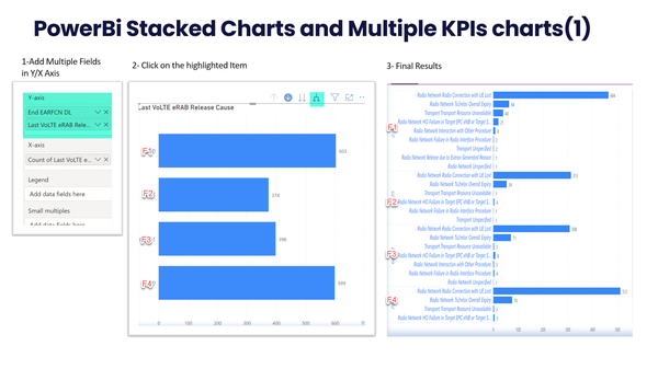
Power BI Advanced Visuals: Stacked and Histogram Charts
Learn how to create advanced Stacked and Histogram Charts using Power-BI.

youtube
Learn how to create advanced Stacked and Histogram Charts using Power-BI.
youtube
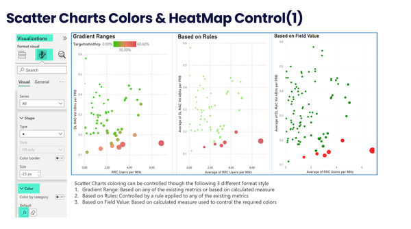
Learn how to create advanced Scattered Charts using Power BI .
youtube
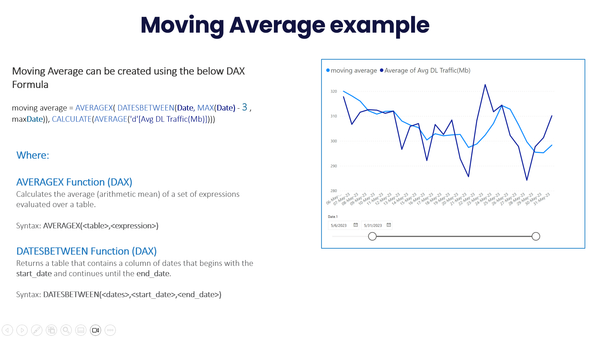
Moving Average Formula: AVERAGEX(DATESBETWEEN([Date] , MAX([Date]) - 4 , MAX([Date])), CALCULATE(AVERAGE([KPI]))) Example for 90perc: PERCENTILE.INC(metric, 0.9)
youtube
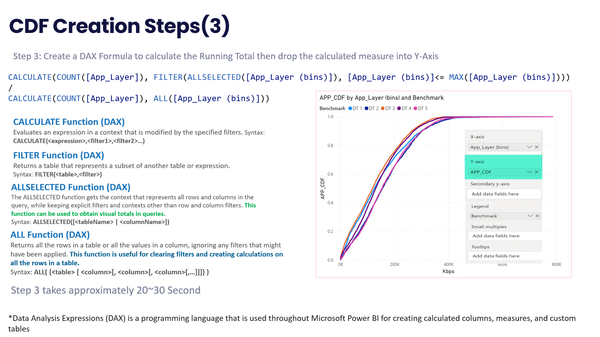
Learn how to create and customize a Cumulative Distribution Function (CDF) chart using Power BI DAX. DAX CDF Formula: CDF Formula: CALCULATE(COUNT([KPI]), FILTER(ALLSELECTED([BINS]), [(BINS)]<= MAX([(BINS)]))) / CALCULATE(COUNT([KPI]), ALL(BINS])) CDF Creation Steps Step 1: Create a Line/Scatter Chart Step 2: Drag the
youtube
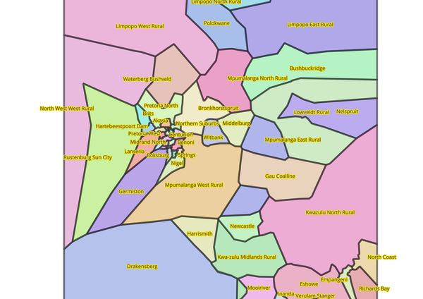
In this QGIS video, you'll learn how to automatically make polygons using the Voronoi tool. We'll show you how to set up your data, run the Voronoi tool, and change the polygons. By the end, you'll know how to quickly create custom polygon layers
youtube
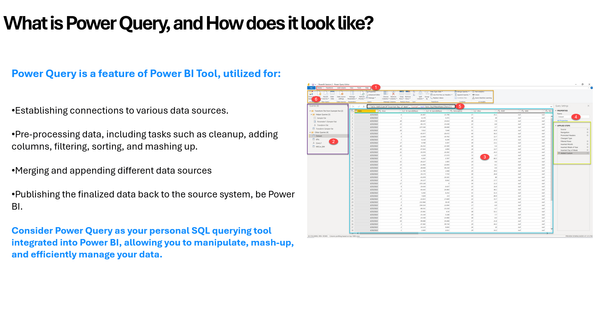
In this video, you'll learn how to master the Power BI Query Editor and apply the best practical techniques for efficient data transformation and preparation. Everything you need to know about the Query Editor is almost covered, with several of practical examples to reinforce the concepts.
Power BI
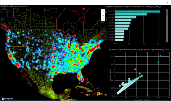
In this video, I'll provide a comprehensive overview of MapBox Maps in Power BI. MapBox is a powerful mapping solution compared to other PowerBi Maps, it offers more advanced visualization capabilities and functionalities, including sector addition and heatmaps. The video will cover the following topics: * Overview and How
youtube
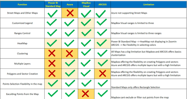
In this video, I'll cover everything you need to know about ARCGIS Maps in PowerBi. Topics include: - Introduction - Plotting points with different colors (Coverage Maps) - Creating HeatMap - Clustering - Excluding areas/points from the map - Importing Postal Codes from Web
materials
youtube
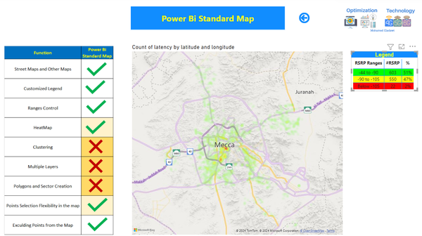
In this video, I'll cover everything you need to know about Power BI standard maps. Topics include: * Plotting points with different colors (Coverage Maps) * Creating customized legends * Zooming, Selecting or excluding areas/points from the map * Creating HeatMaps
youtube
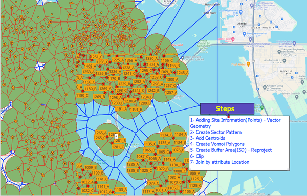
Here are the steps required to add the first neighbor layer: 1- Adding Site Information(Points) - Vector Geometry 2- Create Sector Pattern (Using Shape Tools Plugin) 3- Add Centroids (Using Centroid in Toolbox) 4- Create Voronoi Polygons (Using Voronoi in ToolBox) 5- Create Buffer Area(ISD) - Reproject from Degree to
youtube
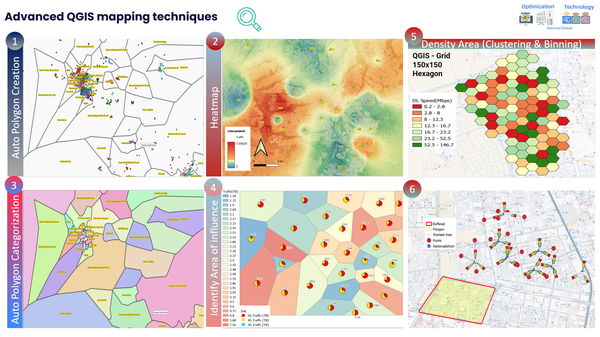
The latest installment of the QGIS training series has been released. In Part 3, we explore advanced mapping techniques in QGIS in-depth. Links to Part 1 and Part 2 can be found in the comments section. 1- Auto Polygon Boundary Creation 2- Voronoi- Identify Area of influence 3- Create
 Mohamed ELAdawi
Telecom Expert | 5G & 6G Trainer
Mohamed ELAdawi
Telecom Expert | 5G & 6G Trainer